Drawn delivery zones vs postcodes in WooCommerce
WooCommerce decides who can get delivery with shipping zones. Out of the box, a zone is a list of countries, states and postcodes. That works well for parcel shipping. For local delivery (restaurants, grocery and farm shops, florists, bakeries) a postcode is often too coarse: one postcode can cover the street around the corner and a village half an hour away.
This guide compares the two approaches and shows how to use them together.
Short answer
Section titled “Short answer”- Postcodes are enough when your delivery area follows postcode borders and one price per postcode is fair.
- Draw the zone when the area follows something postcodes don’t: a river, a bridge, a highway, a city centre with tolls, or a fixed distance from your shop. Also when the price should follow the distance.
- Use both: keep one WooCommerce shipping zone (for example your country) and let Shipping Zones by Drawing decide inside it.
Comparison
Section titled “Comparison”| WooCommerce postcode zones | Shipping Zones by Drawing | |
|---|---|---|
| Delivery area | Countries, states, postcodes (wildcards like 902* and ranges like 90210...90299) |
Areas drawn on a Google map, a radius around the shop, or imported KML polygons |
| Follows rivers, bridges, highways | No | Yes, the drawn line follows any shape |
| Price | Flat rate per method, shipping class costs | Flat rate per zone. Premium: price per km or mile by driving distance, or a fixed price inside a radius plus a price per km beyond it |
| Limit by driving distance or time | No | Premium: car or bike, from the shop or from another origin |
| Several shops or warehouses | No | Premium: one origin per shipping method |
| Map at checkout | No | Customers can place a pin or enter a Google Plus Code |
| Show customers where you deliver | No | [szbd] map on any page |
| Google Maps API key | Not needed | Needed for the maps and address lookups |
| Cost | Included in WooCommerce | Free version on WordPress.org (up to 5 drawn zones), Premium from $39 a year |
When postcodes are enough
Section titled “When postcodes are enough”Stay with postcodes if:
- your area is a set of whole postcodes, and you are happy to deliver to the whole of each one
- the price is the same for every address in a postcode
- you ship parcels with a carrier rather than drive yourself
If you only want customers to check a postcode before they shop, Check My PostCode adds a postcode checker to any page that answers from the shipping zones you already have. Plain postcode checks don’t use Google at all.
When to draw the zone
Section titled “When to draw the zone”Draw the zone when:
- Geography splits a postcode. A river or a motorway without a crossing makes half of a postcode a long detour.
- The city centre costs more. Traffic, tolls and low-emission zones. Draw the centre as its own zone with its own price.
- You deliver along a route. Draw a corridor along the road you already drive, cheaper than the area around it.
- The price should follow the distance. Free within 1 km, then $1 per km, for example. With Premium the distance can be the real driving distance from Google, not a straight line.
- Food has to arrive hot. Premium can limit a method by driving time, by car or bike.
- You have more than one location. Premium measures every distance from the origin you choose per method, and with show only the cheapest method the closest shop wins.
How to use both together
Section titled “How to use both together”- In WooCommerce → Settings → Shipping, create one shipping zone that covers your whole delivery area, for example your country or your state. WooCommerce uses only the first zone that matches an address, so keep all drawn-zone methods in that one zone (why).
- In WooCommerce → Shipping Zones by Drawing, draw your delivery area, or add a radius around the shop. Already have a polygon from Google My Maps? Import the KML file.
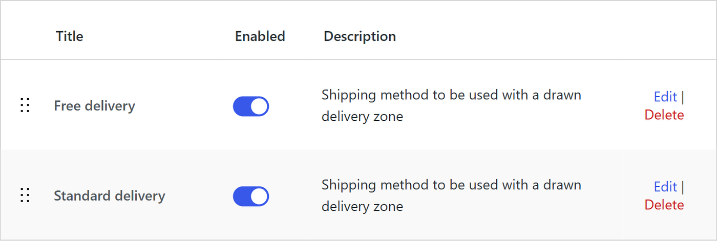
- Add a Shipping Zones by Drawing method to the WooCommerce zone, choose the drawn area and set the price (all method settings).
- Add more methods for more areas or prices. Overlapping areas are fine; with Premium, turn on show only the lowest cost method.
- Check an address in the checkout. Addresses outside every drawn area get no delivery option, so customers can’t order delivery where you don’t go.
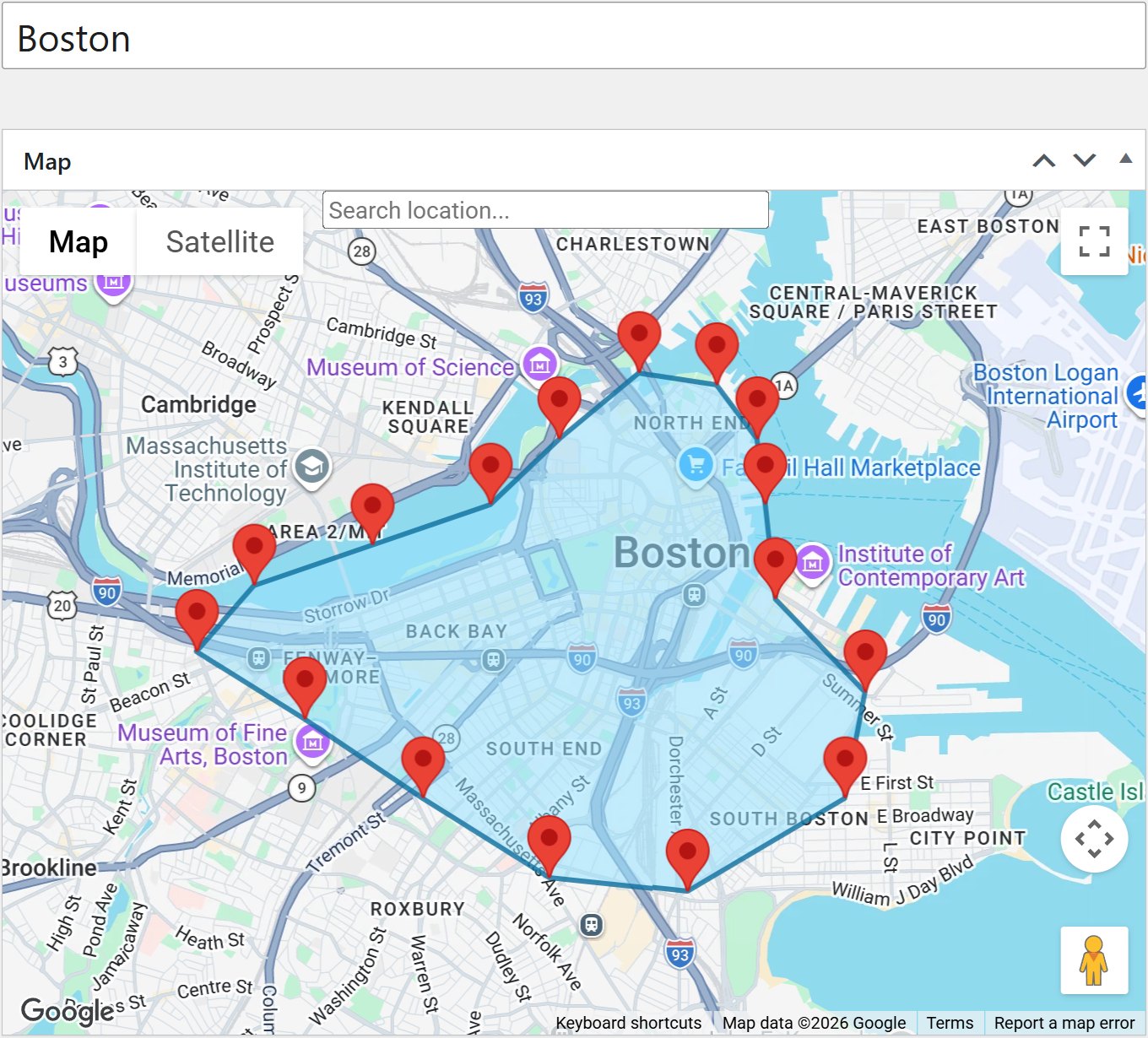
With Shipping Zones by Drawing Premium 3.4.0 or newer, an AI assistant can also set this up for you: “Create a delivery zone with a 5 km radius around the store, with free delivery from 500 and 49 below that.” It shows a preview before anything is saved.
Let customers check before they shop
Section titled “Let customers check before they shop”- Check My Address puts an address checker on any page. With Shipping Zones by Drawing it answers from your drawn zones and shows the price for that exact address. There is a bundle with both plugins.
- The
[szbd]shortcode shows a map of your delivery zones on any page.
Questions
Section titled “Questions”Can I mix postcode zones and drawn zones?
Section titled “Can I mix postcode zones and drawn zones?”Yes. Keep your postcode zones for parcel shipping and add a zone with Shipping Zones by Drawing methods for local delivery. Remember that WooCommerce stops at the first zone that matches an address, so put the local delivery zone above broader zones, or put all methods in one zone.
Does it work with the WooCommerce block checkout?
Section titled “Does it work with the WooCommerce block checkout?”Yes. Shipping Zones by Drawing works with both the block checkout and the classic checkout, and with High-Performance Order Storage.
Do I need a Google Maps API key?
Section titled “Do I need a Google Maps API key?”Yes, for the maps and for turning addresses into coordinates. The Getting Started section shows which APIs to enable. WooCommerce postcode zones alone don’t need Google.
Is there a free version?
Section titled “Is there a free version?”Yes. Shipping Zones by Drawing for WooCommerce on WordPress.org draws up to five zones with flat rates and radius zones. Premium removes the limit and adds distance-based prices, driving distance and time limits, minimum order amounts, several shipping origins and AI assistant access. See shippingzonesplugin.com for examples and pricing.